Satellites usually make money by looking down at Earth. HEO is building a business around looking sideways. Its network uses cameras already flying in orbit, plus HEO-built sensors, to photograph other satellites and space objects. Software then turns those images into inspections and intelligence for operators and governments.1, 2
HEO uses cameras already in orbit, plus its own satellite-mounted sensors, to photograph other spacecraft and debris. Its software coordinates those sensors and turns imagery into inspection and intelligence products. HEO says it raised US$25 million in Series B funding to expand the network into geostationary orbit.1, 2
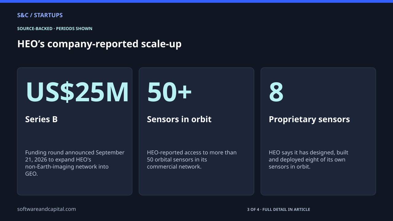
HEO’s company-reported scale-up
Funding round announced September 21, 2026 to expand HEO's non-Earth-imaging network into GEO.
HEO says it has designed, built and deployed eight of its own sensors in orbit.
HEO's planned timing for reliable, repeatable geostationary imaging coverage.
The product is not another picture of Earth
Non-Earth imaging means using a satellite camera to photograph another object in orbit. HEO says its autonomous software identifies imaging opportunities, tasks satellites, processes the resulting imagery and applies AI-powered analysis to produce intelligence about spacecraft and other objects.1
| Layer | What it does | Who can use it |
|---|---|---|
| Partner sensors | Use cameras already flying on other satellites to capture non-Earth imagery. | HEO's network can task partner capacity rather than owning every host spacecraft. |
| HEO cameras | Add dedicated non-Earth-imaging capability where HEO wants more coverage. | Commercial partners and governments can use HEO-built sensors. |
| HEO Inspect software | Plans captures, tasks satellites and provides imagery and insights. | Satellite operators, governments and intelligence users. |
| Analytics | Processes imagery into information about an object's condition or behavior. | Customers making monitoring and operational decisions. |
Using other satellites changes the capital model
HEO combines imagery from cameras aboard existing Earth-observation satellites with data from its own sensors. That means it does not need to own every spacecraft carrying a camera. Partner infrastructure can provide coverage, while proprietary sensors fill gaps and give HEO more control over the network.1
The next expansion is geostationary orbit
HEO says the Series B will fund its first expansion into geostationary orbit, home to many valuable communications, weather and national-security satellites. The company says it has booked its first two GEO launches and plans reliable, repeatable coverage in 2027.1
That is a plan, not a current operating result. The US$25 million financing gives HEO capital to deploy sensors and build partnerships. It does not mean GEO coverage is already complete or that every future launch will happen on the proposed schedule.1
The business can sell one capability in several forms
HEO's current site presents a software platform for tasking missions and pulling imagery and insights, alongside compact cameras that can be mounted on satellites. The company therefore sits across data access, software and hardware rather than operating as a single-purpose imagery vendor.2
Why non-Earth imaging has a market
- Satellite operators need to understand the condition of expensive assets in orbit.
- Governments want better awareness of satellites and debris in increasingly crowded orbital regions.
- A camera already in space can sometimes inspect another object without a dedicated inspection mission.
- Software can turn one-off imagery into a repeatable monitoring and intelligence workflow.
That makes HEO different from Pixxel's hyperspectral-imaging business. Pixxel sells data about Earth. HEO's target is the space infrastructure itself. The camera still creates the raw observation, but the commercial question is what decision the image helps a customer make.
The unusual part of the model is that orbital infrastructure becomes both the subject and the sensor. As more spacecraft are launched, the space economy does not only need more satellites. It also needs ways to inspect, monitor and understand the satellites already up there.
Sources and methodology
Sources checked September 28, 2026. Dates and periods for individual figures are stated beside them.
- HEO: US$25 million Series B and GEO expansion ↗Accessed 2026-09-28
- HEO: Non-Earth Imaging platform and camera products ↗Accessed 2026-09-28
Scope and assumptions
The US$25M financing, 50+ sensor access, eight proprietary sensors and 2027 GEO plan are company-reported figures.
Expansion into geostationary orbit is planned and financed, not equivalent to full current coverage.
HEO serves defence and intelligence customers, so public information does not reveal every capability, contract or use case.
Continue reading
Pixxel Raised $100M to Turn Hyperspectral Satellites Into a Business →